ToolBox
The toolbox button is used to access different drawing tools, drawn overalys and to add objects to the map.
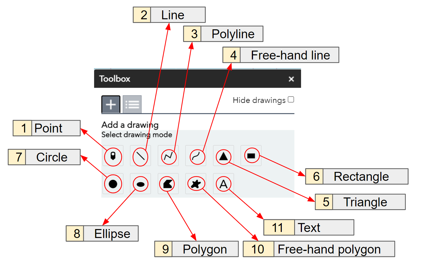
1. Point
This functionality is used to enter any object that would be assigned to a particular grid, such as; key-terrain, military symbols, custom symbols, enemy objectives and point NAI.
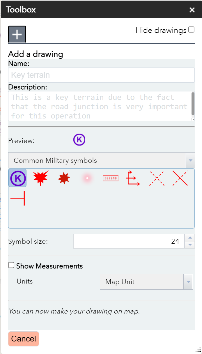
User can customize the symbol name, size, description.
2. Line
The line functionality allows the user to draw a straight line between grids of their choice. The line can be terminated or started with arrows.

User can customize the line name, width, description, color, end/start with arrow and the line opacity.
3. Polyline
This allows the user to draw connected series of straight line segments. It is recommended to use this line when drawing avennues of approach (AA).
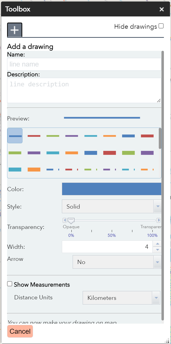
User can customize the line name, width, description, color, end/start with arrow and the line opacity.
4. Free-hand line
This allows the user to draw a line freely using his mouse. It is recommended to use this line when drawing enemy routes, and phase lines. The user draws the line by navigating the mouse from the start position to the end.
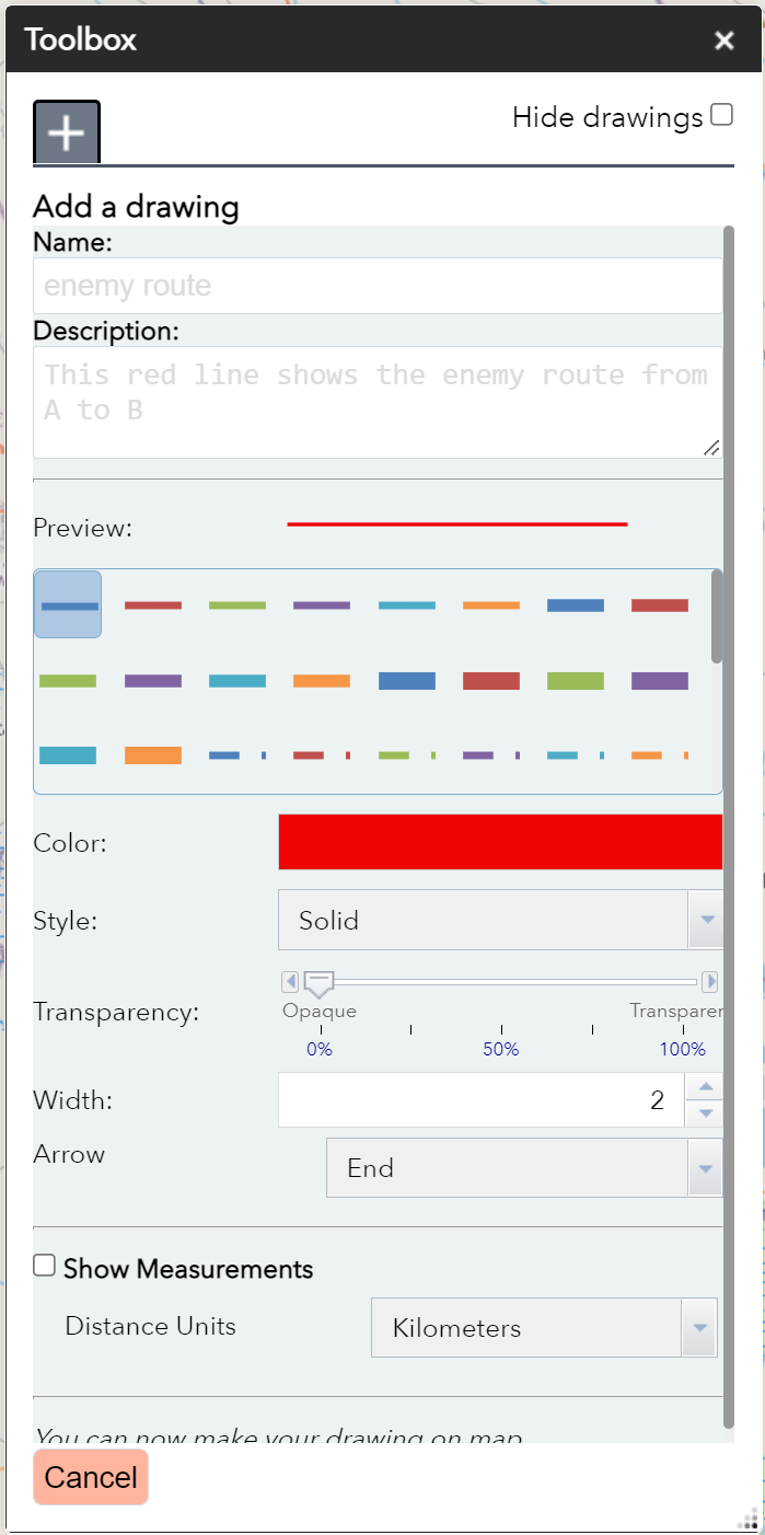
User can customize the line name, width, description, color, end/start with arrow and the line opacity.
5, 6, 7, 8. Triangle, Rectangle, Circle and Ellipse
Triangle, Rectangle, Circle and Ellipse works in similar way expect that they draw different shapes. They allow user to draw prefered shape and the user can easly customize the drawn object.
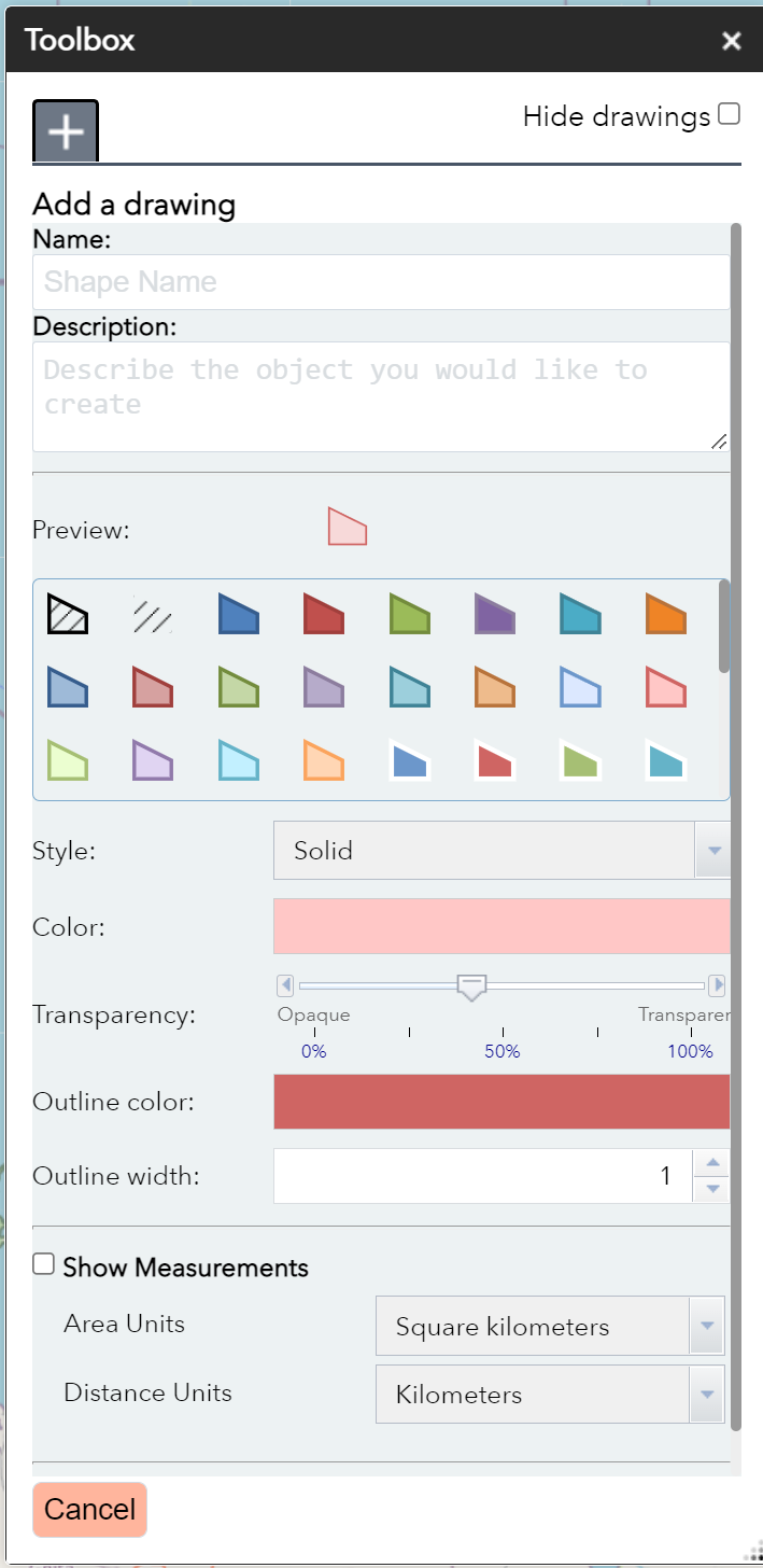
User can customize the ojbject name, width, description, color outline, color fill, and the fill opacity.
9. Polygon
This feature is useful when the user want to draw a polygon with any number of sides, we recommend you to use it for creating the area of operation overall. And any other shaped polygon for highlighting no-go, and slow-go zones.

User can customize the object name, width, description, color outline, color fill, and the fill pattern and opacity.
10. Free-hand polygon
This feature is useful when the user want to draw a polygon freely, we recommend you to use it for highlighting strictly restricted, and non-restricted areas.
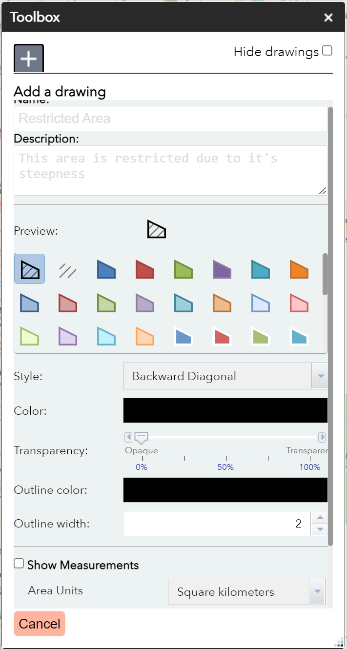
User can customize the object name, width, description, color outline, color fill, and the fill pattern and opacity.
11. Text
It allows the user to add a text to the map and the user can customize the text as he prefers.

The user can change text, name, color font, bold, italic and more.