Getting Started
System access and requirement
Map marker is a secured web-application that can be accessed from any internet connect devices, the system is hosted at Rwanda space agency’s webserver and it can be launched by clicking here. The user should login using his credentials provided by the system admin. For the best experience of the system, it is recommended to access it by using a computer with atleast a screen size of 11 inches, and the user should have atleast 8Mbps internet capacity.
Tools and features
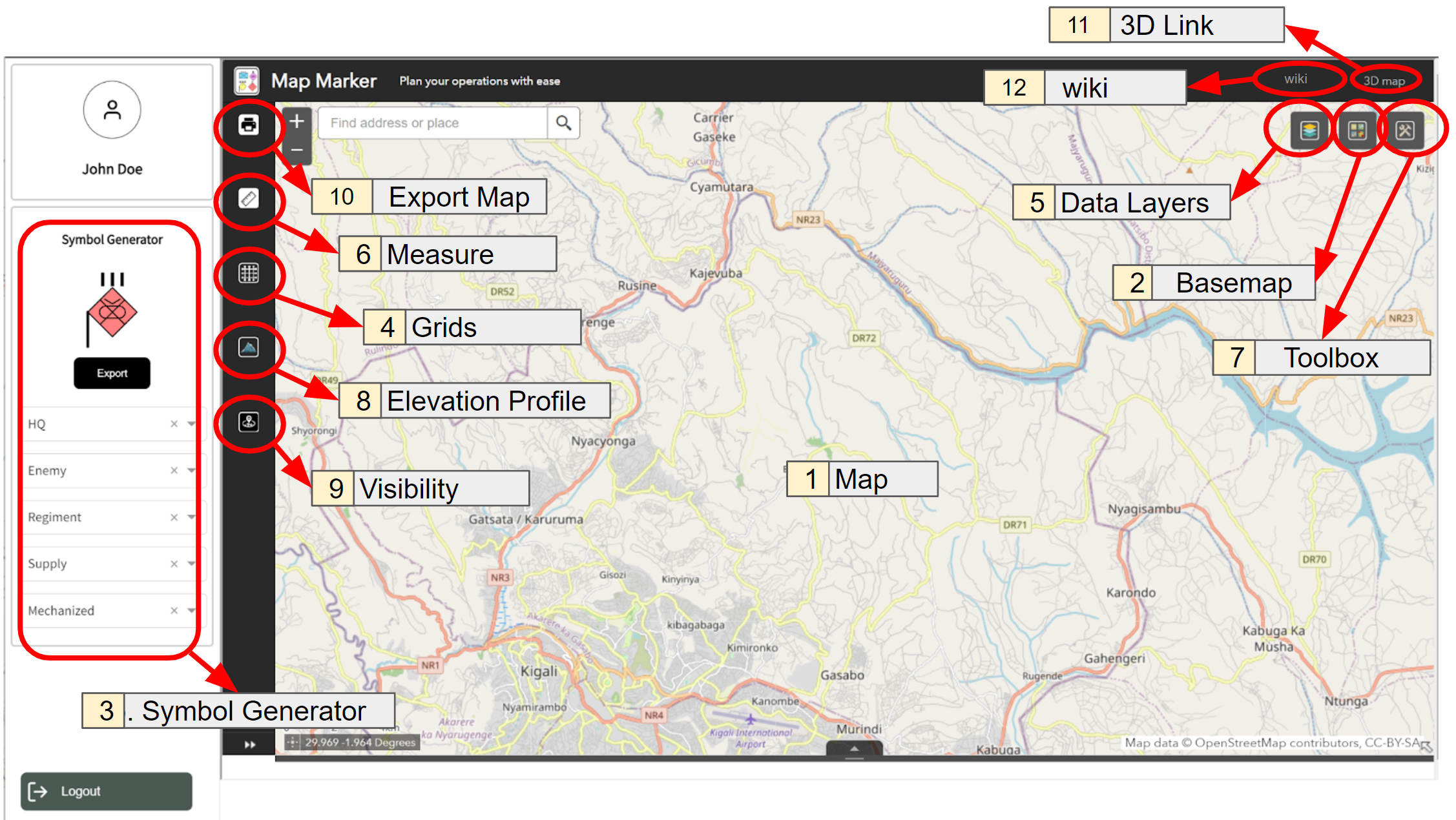
All the tools and features within the mapmarker software are well detailed and located in the following image.

Map: Map occupies the largest part of the app and it’s located in the center of the app. It displays all the information necessary for operations planning and it gives the user a space to create different map overlays.
Basemap: This is one of the buttons located at the top right corner of the app, it used to change basemaps.
Symbol Generator: It is located at the left of the app, it helps the users to generate different military symbols following NATO standard: MIL-STD-2525 and STANAG APP-6
Grids: This button allows the user to activate the standard Military Grids Reference System which is accurate up to 8-figure.
Data layers: This is one of the buttons located at the top right corner of the app, it used to activate or disactivate different data layers.
Measure: This button allows the use to user measure tools from measuring distance, area and coordinates of a particular point.
Toolbox: This is one of the buttons located at the top right corner of the app, it used to access different drawing tools, drawn overalys and to add objects to the map.
Elevation profile: This button allows the user to view two-dimensional cross sectional view of the landscape.
Visibility: The Visibility button determines what is visible from an observer location based on a given distance, an observer height, and a field of view.
Export map: Allows the user to print the map extent including the activated operation overlays.
3D Link: Allows the user to visualize the planned operations in 3D map.
Wiki: The wiki link allows the user to open system user manual and documentation.